

City of Milton: Municipal Route Logistics
Building a secure municipal tracking platform to improve pedestrian transit and support student safety across local school districts.
- Real-Time
- Geolocation Tracking
- Encrypted
- Parent Authentication
- Scalable
- Municipal Infrastructure


Overview
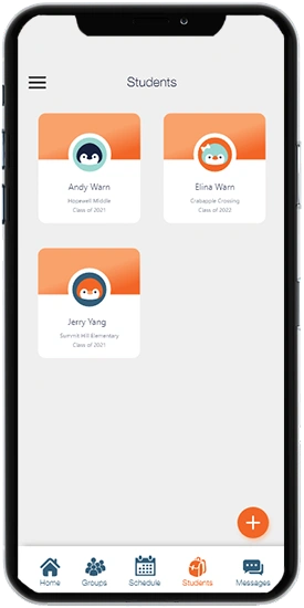
The City of Milton app is a municipal digital platform designed to support safer student walking routes. The application connects parents, schools, and volunteer supervisors through real-time geospatial tracking, giving local districts a centralized way to coordinate pedestrian safety and route information.
Our Approach
Securing pedestrian transit across school districts requires coordination between parents, volunteers, and local authorities. We developed a municipal platform that brings these groups into a shared, real-time system for managing student walking routes and related safety information.
-
Geospatial Route Planning
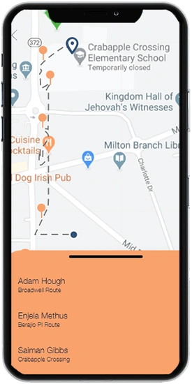
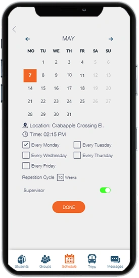
The application allows parents to map and review designated walking routes within the Crabapple district. Approved routes give families and supervisors a clear reference for student movement within the community.
-
Real-Time Transit Tracking
We integrated mapping services to provide live route and location information. Parents and volunteer supervisors can monitor active trips and respond more quickly when a student moves outside the expected route.
-
Encrypted Community Networking
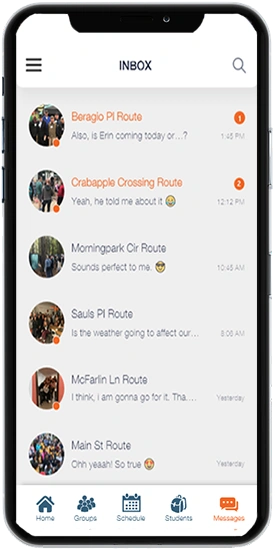
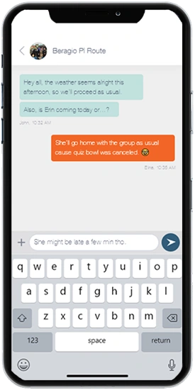
Student-related information requires controlled access. The platform uses authentication controls that limit access to verified parents and designated volunteers, helping protect sensitive community data.
-
Legacy System Integration
Municipal applications often need to work alongside existing school systems. We developed database integrations to exchange relevant information with established educational and city infrastructure while keeping records synchronized.

Hurdles in the Project
Architecting a district-wide student safety platform required reliable geofencing, strong access controls, and integration with existing school databases.
-
Real-Time Geofencing Logic
Monitoring student movement across multiple schools requires accurate location processing and boundary detection. We developed geofencing logic to identify when a user moves beyond an approved route and support timely notifications.
-
Legacy School Integrations
Connecting a modern mobile application with existing municipal and school systems introduced complex data-integration requirements. We built custom API connections to exchange relevant student information while maintaining controlled access to the underlying systems.
-
Multi-Stakeholder Access Control
The platform serves parents, volunteers, and city officials, each with different access requirements. We implemented role-based authentication and data protection measures to ensure sensitive location information is available only to authorized users.
Building City of Milton in four phases
-
Requirements & Blueprinting
We assessed the municipal safety requirements of the Crabapple district and defined the technical requirements for geospatial tracking, route management, and secure communication.
-
Interface Prototyping
The design team created accessible, minimalist interfaces that made route mapping and transit monitoring straightforward for parents and other community users.
-
Native Systems Build
Developers built the native mobile applications with Swift and Kotlin alongside a Node.js backend designed to process and manage real-time location updates.
-
District-Wide Rollout
The platform underwent security testing of its authentication systems before deployment across the local community, where parents, volunteers, and other authorized users could begin using the system.

Solutions Offered for Municipal Safety
-
Geospatial Route Planning: Developed interactive mapping tools that help parents identify, review, and manage designated pedestrian routes to local school zones.
-
Live Location Tracking: Integrated GPS and mapping services to provide ongoing visibility into active student transits across the community.
-
Encrypted Authentication: Built secure authentication workflows that restrict platform access to verified parents, volunteers, and other authorized users.
-
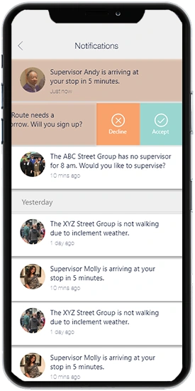
Geofencing Alerts: Implemented digital route boundaries that detect deviations from approved paths and trigger notifications for designated supervisors.
-
Legacy System Bridges: Created custom RESTful APIs to synchronize relevant data with existing school and municipal databases while maintaining controlled system access.
-
Cross-Platform Applications: Delivered mobile applications for both iOS and Android, providing a consistent experience for parents, volunteers, and other community users.
Tech stack
Technologies
Built with a modern, scalable technology ecosystem.
-
Frontend
-
 React.js
Frontend
React.js
Frontend
-
-
Backend
-
 Node.js
Backend
Node.js
Backend
-
-
Database
-
 SQL Server
Database
SQL Server
Database
-
-
Hosting
-
 AWS Cloud Infrastructure
Hosting
AWS Cloud Infrastructure
Hosting
-
-
Mobile
-
 Swift (iOS)
Mobile
Swift (iOS)
Mobile
-
Our Strategy
-
Geofencing & Location Testing
- Refined geospatial tracking logic for accurate route monitoring.
- Tested location updates across the three participating school zones.
- Validated alert triggers using simulated route deviations.
-
Security & Encryption Testing
- Applied authentication controls for parent, volunteer, and administrative accounts.
- Protected live transit and user data through secure data-handling practices.
- Tested legacy API connections to limit unauthorized access to municipal systems.
-
UI/UX Friction Reduction
- Simplified the native interface for quick, straightforward navigation.
- Made route planning accessible to parents with different levels of technical experience.
- Tested application performance across iOS and Android devices.
-
Community Deployment
- Deployed the platform across the participating Crabapple school community.
- Supported onboarding for parents, volunteers, and other authorized users.
- Prepared the cloud infrastructure to accommodate broader district usage as adoption increased.
Impact Snapshot
- 96% Citizen Accessibility
- 90% Information Delivery
- 2X Community Engagement
- Real-Time ROUTE TRACKING
- Automated GEOFENCING ALERTS

Client Testimonial
The team asked better questions than we did. We arrived with a feature list and left the first workshop with a shorter one that actually described the program. Twelve weeks later our clients had something they open every morning.